
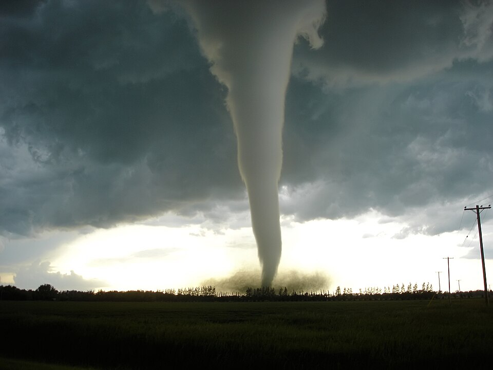
A large tornado moving through central Nebraska was captured on video Sunday night as a severe weather outbreak tore across the Plains and Upper Midwest, producing tornadoes, giant hail, destructive wind gusts and widespread damage from Nebraska and South Dakota into Iowa and Minnesota. Multiple tornado warnings were issued throughout the evening, including a rare Tornado Emergency near Hebron, Nebraska, as powerful supercells tracked across the region. Large hail up to 3.5 inches in diameter was reported in parts of Nebraska, while damaging winds knocked out power to thousands across portions of South Dakota near the Nebraska border. Storm reports included damaged buildings, overturned campers, downed trees and power lines, along with numerous reports of destructive hail and wind damage. Tornado-warned storms pushed into the Omaha metro area and western Iowa as the severe threat continued eastward overnight. The weekend outbreak also prompted reports of tornadoes in Iowa, Kansas and Nebraska, and hail the size of baseballs in Kansas, Missouri, Iowa and Nebraska, according to ABC News. Thunderstorms near Concordia, Kansas, on Saturday produced estimated wind gusts of 90 mph, knocking down trees and power lines, and Hill City Airport in northwest Kansas reported gusts up to 82 mph. The strong winds on Saturday also fueled dust storms that threatened driving conditions. Thunderstorms Saturday night prompted a flash flood emergency in central Grundy County, Missouri, including the city of Trenton, when six to eight inches of rain fell in a matter of hours. Monday is expected to bring an even more dangerous setup. The Storm Prediction Center has issued a rare Level 4 out of 5 risk for parts of Kansas and Nebraska, where conditions may support strong, long-track tornadoes, giant hail and widespread damaging winds. Fox Weather reported that forecasters warn the Monday system could be more dangerous than Sunday's outbreak. The greatest risk areas for Monday, a level 3 out of 5 enhanced risk according to the National Weather Service, stretch from east-central Nebraska up to southwest Minnesota and include the cities of Sioux Falls, South Dakota, and Grand Island, Nebraska. Far southeast Nebraska falls into a moderate risk zone. Chances for severe storms are expected to increase after 3 p.m. Monday as a cold front passes, with very large hail, 65 to 75 mile per hour wind gusts, and a few strong tornadoes possible with any stronger storms that develop. The severe weather threat is forecast to extend into Tuesday and remain especially active from north-central Oklahoma up through Minnesota and western Wisconsin. The National Weather Service also warned that dry and windy conditions with lightning and dry thunderstorms may support hazardous fire activity across the Southwest into the southern High Plains alongside the storm system pushing through the central Plains. Millions of residents across the region remain at risk as the multi-day outbreak continues into the coming week.
News
Tornado Outbreak Hits Plains and Midwest with More Storms Coming Monday
The Storm Prediction Center issued a rare Level 4 out of 5 risk for parts of Kansas and Nebraska ahead of Monday's storm system.
By Free News Press Editorial Team
Published May 17, 2026 at 9:35 PM PDT