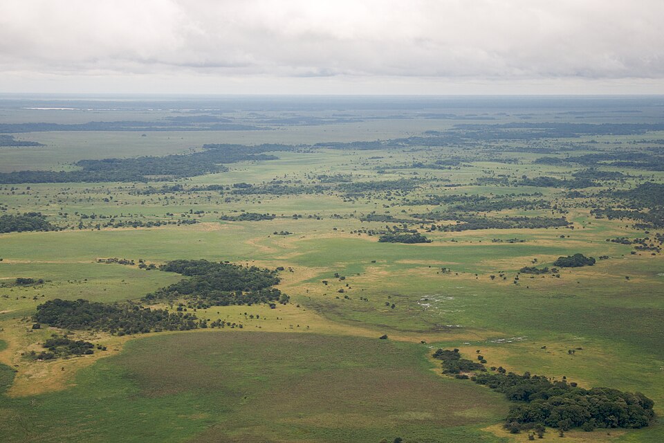
Flying low over the Llanos de Moxos in northern Bolivia, the landscape below looks like a scattered patchwork of grassland, forest patches, and lakes. It appears almost random. But as the plane banks and tilts, a pattern begins to emerge: raised causeways connecting forest islands, canals threading across the terrain, enclosures and roads laid out in a structured geometry that stretches farther than the eye can follow.
On the ground, almost none of this is visible. Stand on the open savannah and the horizon feels empty. Step into the forest and the canopy closes overhead. The earth softens underfoot. Mosquitoes swarm. The ancient structures beneath are reduced to faint rises and shallow depressions in the soil.
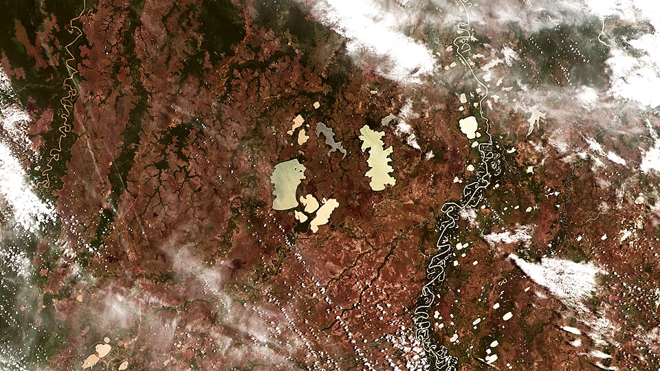
According to a report by Phys.org, advances in lidar technology have transformed what researchers can see in landscapes like this one. Lidar works by firing rapid laser pulses from a plane or drone toward the ground. Most pulses reflect off the forest canopy, but some penetrate through and bounce back from the earth below. By measuring how long each pulse takes to return, the system builds a precise three-dimensional model of the terrain beneath the vegetation.
What that model revealed in the Llanos de Moxos was not a collection of scattered settlements but an entire urbanized landscape. A large portion of the region in the southeast belonged to the Casarabe culture, which was active from approximately AD 500 to 1400. The area it covered spans roughly 20,000 square kilometers, about the size of the state of New Jersey.
The Casarabe organized their territory into a hierarchy of four settlement sizes. The largest, called primary settlements, reached up to 3 square kilometers, or 300 hectares. That is enough space for more than 400 football pitches and suggests these places supported substantial populations.
Those primary settlements were connected to smaller ones through a system of raised causeways and canals. Seen from above through lidar data, the network reads as a coherent, planned infrastructure spread across a vast area, one that remained invisible to researchers for centuries because the forest had grown over and around it.
The Llanos de Moxos sits in a region of Bolivia that experiences dramatic seasonal flooding. The raised causeways and canals were likely part of how the Casarabe managed water and movement across a landscape that would have been difficult to navigate on foot for much of the year.
Lidar has reshaped archaeology across the Amazon and beyond over the past two decades, stripping away the visual noise of dense vegetation to expose what lies beneath. The Casarabe findings are among the most extensive urban landscapes it has uncovered in the Americas, adding to a growing body of evidence that large, complex societies existed deep in Amazonia long before European contact.