

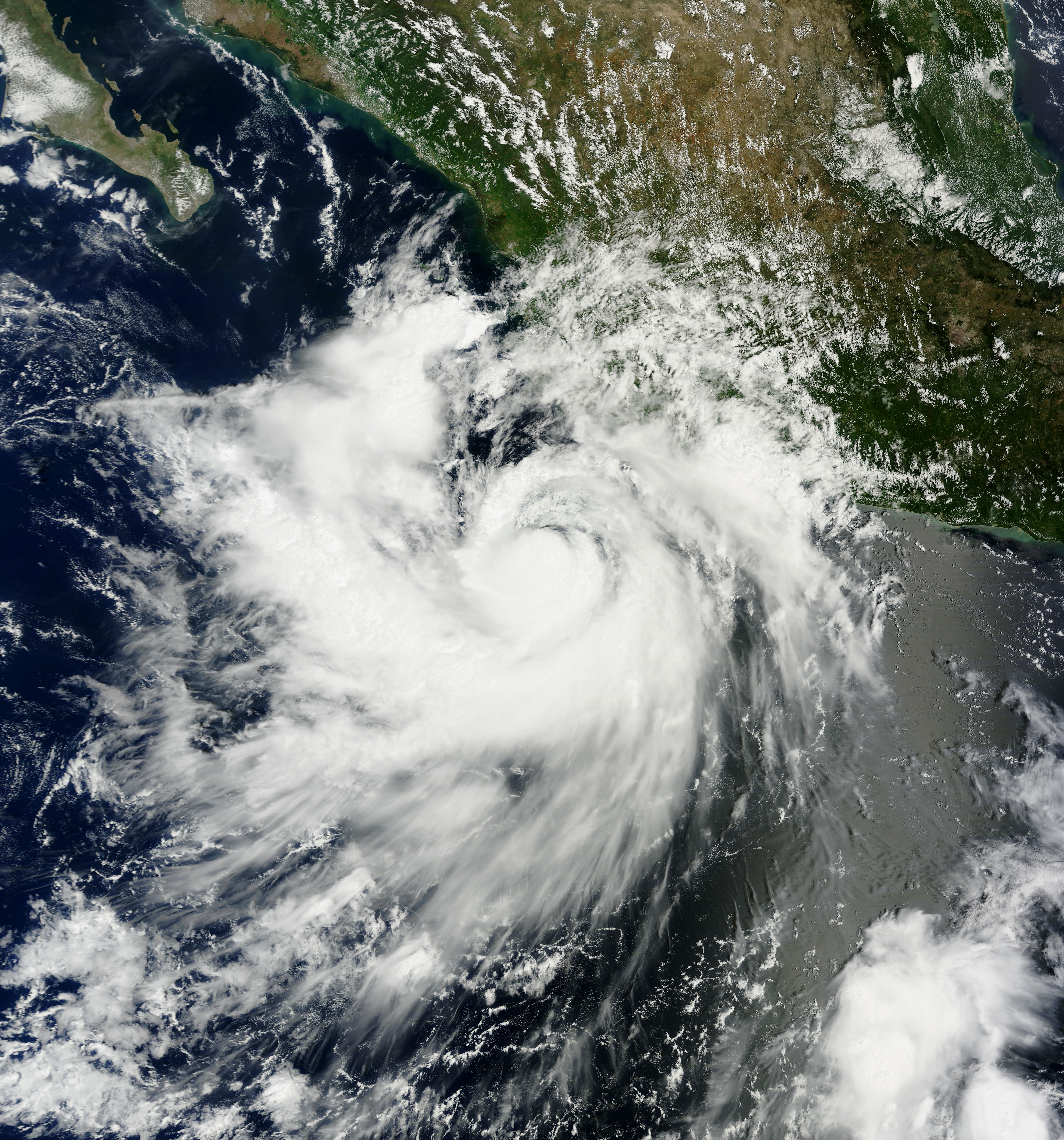
Hurricane Polo has grown into one of the most powerful cyclones in decades, threatening Mexico’s southwestern coast as a Category 5 storm.
The National Hurricane Center said Polo had maximum sustained winds of 160 mph late Wednesday. The storm was centered about 130 miles south-southwest of Zihuatanejo and was moving northwest at 6 mph.
Polo has undergone major fluctuations in strength. It reached maximum sustained winds of 180 mph on Tuesday before weakening on Wednesday. It then strengthened back into a Category 5 hurricane Wednesday evening.
Forecasters said the hurricane is expected to remain offshore as it moves northwest and eventually west-northwest away from Mexico. However, the National Hurricane Center warned that dangerous conditions can still reach the coast even if Polo's center never makes landfall.
Hurricane-force winds have extended outward up to about 40 miles from the center and tropical storm-force winds up to about 105 miles away during portions of the storm's approach.
Residents along Mexico’s Pacific coast were on high alert after being hit by strong cyclones in recent years, according to the Associated Press. Beaches emptied out and dark clouds covered the choppy seas as authorities suspended classes in many areas. Mexican authorities also prepared shelters and deployed emergency personnel to areas at risk.
Concepción López Villegas was preparing her seaside restaurant for possible damage from the storm. Waves were already reaching her city of Lázaro Cárdenas in Michoacán. She said she feared the waves would destroy the business she has built over decades. López Villegas said they were worried and trying to protect their businesses.
National Hurricane Center data showed Polo’s winds reached speeds comparable to only a small number of eastern Pacific hurricanes in recent decades. Hurricane Patricia reached 215 mph in 2015 and remains the benchmark for extreme intensity in the basin.
Kristen L. Corbosiero, a professor of atmospheric and environmental sciences at the University at Albany, described Polo as one of the strongest storms ever recorded in the Pacific basin.
At its peak Tuesday, Polo had winds of 180 mph and a minimum central pressure of 892 millibars. The National Hurricane Center obtained those measurements from a NOAA Hurricane Hunter aircraft.
The National Hurricane Center warned that tropical storm conditions were expected along portions of the coast in Guerrero and Michoacán. Tropical storm watches have also covered areas farther northwest along the coast.
Heavy rain was forecast to cause flash flooding and mudslides. About 3 to 6 inches of rain were expected in Guerrero and Michoacán, with smaller amounts possible in coastal parts of Oaxaca, Colima and Jalisco.
Polo’s outer rainbands were already reaching southwestern Mexico by Wednesday. The National Hurricane Center warned that some of the heaviest rainfall could fall in coastal Guerrero.
The U.S. Embassy in Mexico issued a weather alert urging citizens to avoid beaches and water. It warned that even without direct landfall, heavy rain could cause deadly flooding and mudslides. The embassy also noted that dangerous ocean conditions including rip currents and rogue waves may occur.
The embassy said Polo could also affect travel. It advised people to monitor local authorities and prepare shelter and evacuation plans.
Scientists were surprised by how quickly Polo gained strength. The storm went from a tropical storm to an extremely powerful Category 5 hurricane in roughly a day.
The National Hurricane Center described the rate of strengthening as remarkable. Polo intensified from around 50 mph to as high as 180 mph during its rapid development.
Philip Klotzbach of Colorado State University linked the favorable conditions to El Niño. He said El Niño tends to create warmer water and atmospheric conditions in the eastern Pacific that can help hurricanes strengthen quickly.
Those same conditions can have the opposite effect in the Atlantic. Strong El Niño conditions often increase wind shear there and disrupt developing tropical systems.
Polo is the third Category 5 hurricane of the eastern Pacific season, following Genevieve and Lowell earlier in the year. The three storms tied the record for the most Category 5 hurricanes in the eastern North Pacific by September 22.
Category 5 is the highest level on the Saffir-Simpson Hurricane Wind Scale. It applies to hurricanes with sustained winds of at least 157 mph.
The Atlantic hurricane season has moved in the opposite direction. No Atlantic hurricane had formed as of this week, setting a record for the latest start to an Atlantic season without a hurricane.
El Niño is one reason for the contrast between the two basins. It has helped suppress Atlantic development while creating more favorable conditions for tropical cyclones in the eastern Pacific.
Despite Polo's extraordinary strength, forecasters continue to expect the center to remain offshore. The primary dangers for Mexico are heavy rainfall, flooding, mudslides, dangerous surf and tropical storm-force winds along portions of the coast.