

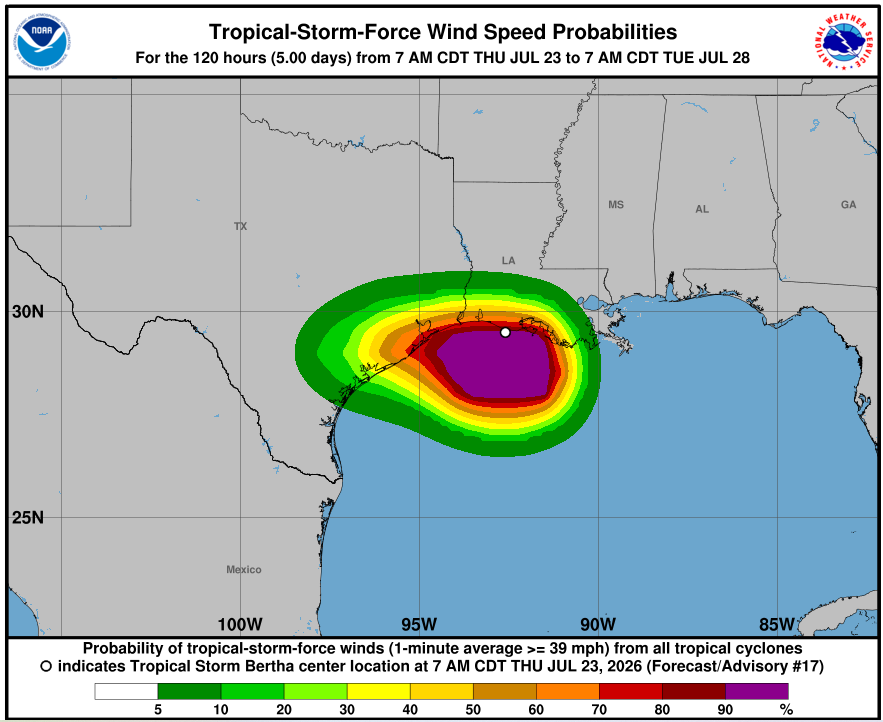
Tropical Storm Bertha made landfall in southeast Louisiana on Wednesday afternoon and moved back over open water before striking the Texas coast on Thursday. As of 5 a.m. ET Thursday, the storm was approximately 95 miles southeast of Lake Charles, with sustained winds near the center of 45 mph and gusts over 40 mph along parts of the Louisiana coast.
Bertha was moving west at 13 mph and was expected to hold its current strength through its second landfall, according to ABC News. A tropical storm warning was in place from southern Louisiana along the Texas coast to Brazosport, which includes Galveston.
After landfall along the Texas coast, Bertha was expected to dissipate quickly. However, the threat from storm surge remained significant. Up to 3 feet of surge could be possible from the mouth of the Mississippi River in Louisiana to Port Bolivar, Texas.
Swells generated by Bertha were expected to continue spreading westward along the northern Gulf Coast over the following days. Those swells are likely to cause life-threatening surf and rip current conditions along the coastline.
Rainfall totals varied by location. The Corpus Christi area was forecast to see the most rain from the storm, with 1 to 4 inches possible through Thursday night.