

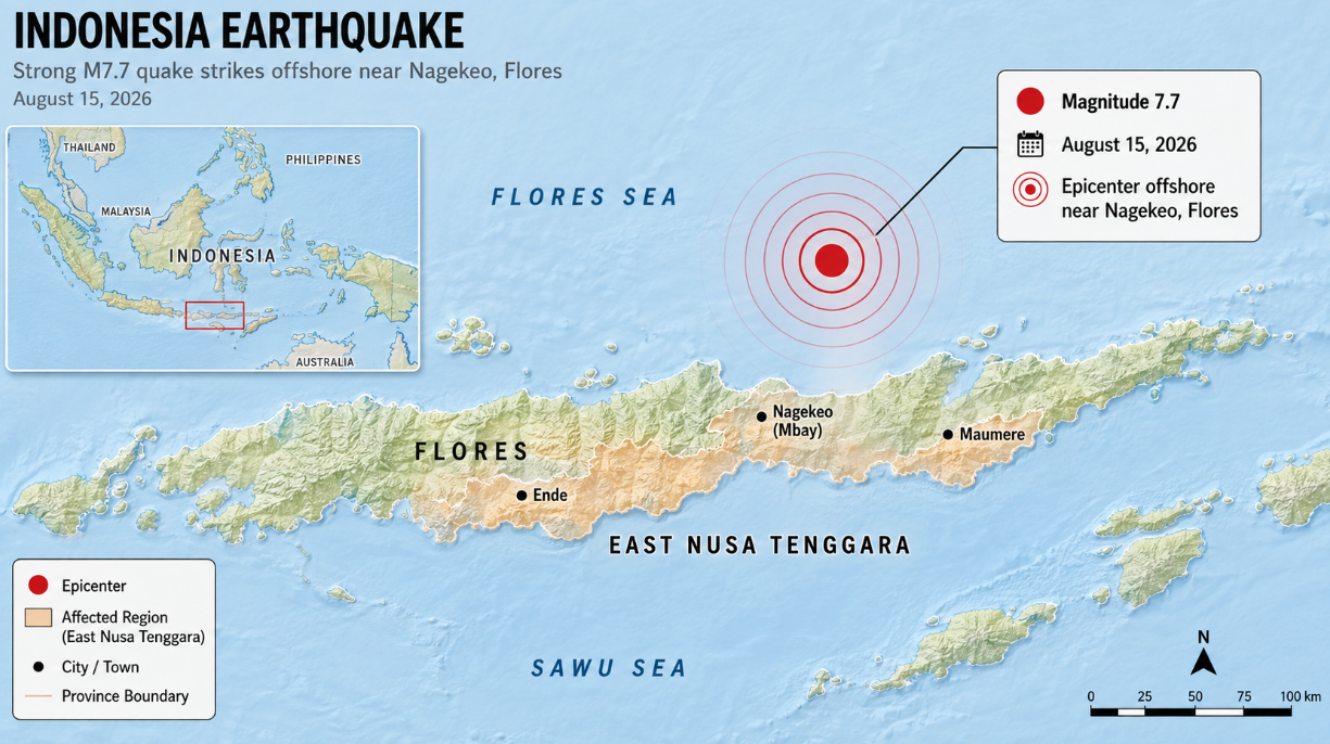
A powerful magnitude 7.7 earthquake struck eastern Indonesia early Saturday, killing at least five people, damaging buildings and sending residents rushing from their homes. The earthquake hit near the island of Flores in East Nusa Tenggara province shortly before 6 a.m. local time on August 15.
Indonesia’s Meteorology, Climatology and Geophysics Agency, known as BMKG, said the earthquake was centered in the sea about 30 kilometers northeast of Nagekeo in East Nusa Tenggara. The agency placed the depth at approximately 15 kilometers. BMKG initially measured the earthquake at magnitude 7.0 before updating it to 7.7 following additional analysis.
East Nusa Tenggara Governor Emanuel Melkiades Laka Lena said at least five people had been reported dead as information continued to arrive from communities across Flores. The victims were reportedly killed when buildings collapsed during the strong shaking. Earlier casualty reports from Indonesia’s national disaster agency were lower as emergency crews were still collecting information from affected areas.
Search and rescue teams were deployed to several locations. Indonesia’s National Search and Rescue Agency, Basarnas, said three people were pulled from the debris of a collapsed building at the Lorens Say port area in Maumere. One of those victims died, while two others were injured and taken to a hospital for treatment.
The earthquake caused widespread panic across Flores and surrounding islands. Reuters reported that strong shaking was felt throughout East Nusa Tenggara, West Nusa Tenggara and parts of South Sulawesi. Residents in some communities said the shaking continued for about a minute. Approximately 2,000 people in Nagekeo evacuated as authorities assessed damaged homes, warehouses and government buildings.
Power outages and traffic congestion were also reported in affected communities. In Ende, hospital patients were moved outdoors as officials evaluated the safety of buildings. At least one landslide was reported, while images and video from Maumere showed damaged structures and debris around the port area.
The earthquake initially triggered a tsunami warning for several coastal regions. BMKG modeling indicated that parts of East Nusa Tenggara, West Nusa Tenggara and South Sulawesi could potentially experience waves between 0.5 and 3 meters in areas placed under the agency’s Siaga warning level. Other areas were placed under a lower warning level for waves below 0.5 meters.
Actual tsunami waves recorded following the earthquake were less than one meter, according to Reuters. BMKG later ended the tsunami warning at approximately 7:30 a.m. western Indonesian time after monitoring stations showed that the immediate threat had passed. The agency said it would continue monitoring sea levels and earthquake activity.
The main earthquake was followed by a series of aftershocks. Authorities warned residents to remain cautious because additional strong shaking was possible. A magnitude 6.2 earthquake was reported later near Labuan Bajo in western Flores, and damage was reported to buildings in that area as well.
BMKG said the magnitude 7.7 earthquake was caused by movement along the Flores back-arc thrust fault system. This system runs through a highly active seismic region north of the Indonesian islands of Flores and Bali. BMKG earthquake and tsunami director Wijayanto said the fault is capable of producing earthquakes approaching magnitude 7.8 to 7.9.
The region has experienced destructive earthquakes before. BMKG pointed to a magnitude 7.5 earthquake in 1992 that caused severe damage in Flores. The December 1992 Flores earthquake also generated a devastating tsunami, making coastal communities particularly sensitive to tsunami warnings following major offshore earthquakes.
Indonesia experiences frequent earthquakes because it lies along the Pacific Ring of Fire, where several major tectonic plates interact. The country’s thousands of islands sit near numerous active faults and subduction zones, making earthquakes and volcanic eruptions a continuing hazard.
Emergency crews were continuing to inspect damaged communities Saturday as local governments collected reports from across Flores. Officials warned that casualty and damage figures could change as rescuers reach more remote communities. The government of East Nusa Tenggara said it was coordinating with local authorities throughout Flores to assess conditions and organize the emergency response.